


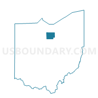
RIPLEY TWP, Huron County, Ohio
About
Outline

Summary
| Unique Area Identifier | 648035 |
| Name | RIPLEY TWP |
| County | Huron County |
| State | Ohio |
| Area (square miles) | 25.65 |
| Land Area (square miles) | 25.59 |
| Water Area (square miles) | 0.07 |
| % of Land Area | 99.74 |
| % of Water Area | 0.26 |
| Latitude of the Internal Point | 41.03838740 |
| Longtitude of the Internal Point | -82.57354590 |
Maps


Graphs
Select a template below for downloading or customizing gragh for RIPLEY TWP, Huron County, Ohio


Neighbors
Neighoring Voting District (by Name) Neighboring Voting District on the Map
- BLOOMINGGROVE TOWNSHIP, Richland County, OH
- CASS A, Richland County, OH
- FAIRFIELD TWP, Huron County, OH
- FITCHVILLE TWP, Huron County, OH
- GREENFIELD TWP, Huron County, OH
- GREENWICH TWP, Huron County, OH
- NEW HAVEN TWP 1, Huron County, OH
Top 10 Neighboring County Subdivision (by Population) Neighboring County Subdivision on the Map
- New Haven township, Huron County, OH (2,621)
- Cass township, Richland County, OH (1,647)
- Greenfield township, Huron County, OH (1,374)
- Fairfield township, Huron County, OH (1,218)
- Bloominggrove township, Richland County, OH (1,204)
- Fitchville township, Huron County, OH (1,056)
- Greenwich township, Huron County, OH (1,044)
- Ripley township, Huron County, OH (1,024)
Top 10 Neighboring Unified School District (by Population) Neighboring Unified School District on the Map
- Willard City School District, OH (11,053)
- New London Local School District, OH (6,038)
- Plymouth-Shiloh Local School District, OH (5,217)
- South Central Local School District, OH (4,983)
Top 10 Neighboring State Legislative District Lower Chamber (by Population) Neighboring State Legislative District Lower Chamber on the Map
Top 10 Neighboring State Legislative District Upper Chamber (by Population) Neighboring State Legislative District Upper Chamber on the Map
Top 10 Neighboring 111th Congressional District (by Population) Neighboring 111th Congressional District on the Map
Top 10 Neighboring Census Tract (by Population) Neighboring Census Tract on the Map
- Census Tract 9164, Huron County, OH (5,114)
- Census Tract 9165, Huron County, OH (4,845)
- Census Tract 29, Richland County, OH (4,191)
- Census Tract 28, Richland County, OH (3,730)
- Census Tract 9161, Huron County, OH (3,625)